There is 178+ petabytes of data in NASA's Earthdata repository, and plenty of projects working to make it accessible. But as a computer scientist who works at the intersection of NASA and Earth-science informatics, I find dataset names like this kind of uninviting and intimidating:
MODIS/Aqua Land Surface Temperature/Emissivity Daily L3 Global 1km SIN Grid V061
Even after reading that name and its official description page, not much clicks for me.
But if the same dataset were described in plain English —
"How hot the land surface gets each day, from NASA's MODIS sensor on the Aqua satellite (~1 km detail)."
— suddenly it feels more approachable.
Here are a few more — the actual technical names next to a plain-English version:
| The dataset's technical name | In plain English |
|---|---|
| MODIS/Terra Land Surface Temperature/Emissivity Daily L3 Global 1km SIN Grid V061 | How hot the land surface gets each day, from NASA's MODIS sensor on the Terra satellite (~1 km detail) |
| GPM IMERG Final Precipitation L3 Half Hourly 0.1° × 0.1° V07 | How much rain and snow fell worldwide, every 30 minutes, from the GPM satellite network |
| VIIRS/NPP Imagery Resolution 6-Min L1B Swath 375 m | Raw sharp satellite images (visible and infrared), from NASA's VIIRS sensor on Suomi-NPP (375 m detail) |
| VIIRS/NPP Imagery Resolution Terrain Corrected Geolocation 6-Min L1 Swath 375 m | Where each image pixel sits on Earth, from NASA's VIIRS sensor on Suomi-NPP (375 m detail) |
| VIIRS/NPP Daily Gridded Day Night Band 15 arc-second Linear Lat Lon Grid Night V2 | Raw nighttime brightness measured at the satellite each day, from VIIRS on Suomi-NPP |
So I thought: if the data were more accessible and inviting to non-earth-scientists — getting more students and enthusiasts interested in what's actually there, and how to use these datasets, all in plain English — it would lower the barrier a lot.
So, as an experiment, I translated 3,000+ NASA Earthdata datasets into plain English and built a curated catalog of the top 300, each with an AI-generated cover image:
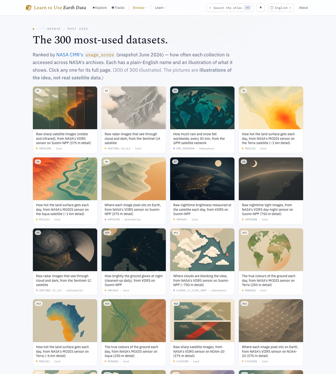
Explore it → earthdata.ajinkya.ai/top-datasets
The paper. I have written this experiment up formally in Plain-Language Names for NASA Earthdata: An LLM Experiment in Dataset Discoverability for Non-Specialists (Zenodo, 2026).